Transport region helps municipalities improve risky cycle paths
The Amsterdam Transport Region uses data analysis to selects cycle paths where most single party accidents of cyclists occur. With this information and in collaboration with the road owners (municipalities and province), cycle paths are made safer. By making them wider, removing bollards, safer curbs, etc.
‘Safe Cycle Paths Programme’ is the name of the approach of the Amsterdam Transport Region to reduce the number of single party bicycle accidents on protected (segregated) cycle paths. The reason for starting this program was the Regional Road Safety Monitor, says Thomas Preeker, programme manager mobility at the Transport Region: ‘The monitor shows that 73% of all (serious) accidents are single party bicycle accidents. These are accidents without other drivers involved. The infrastructure causes the accident. We also see the share of cyclists among the injured increasing, while it is stable for cars. With this project we want to do all we can to prevent a further increase.’
Six design principles
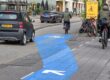
Six scientifically substantiated ‘design principles’ are used to make cycle paths safer. These six are forgiving curbs, obstacle-free verges, removing posts and other obstacles, visual guidance (for example markings along the edge of cycle paths to keep cyclists on course), sufficient width for the number of cyclists, and road surface that is ‘flat, rough (not slippery) and clean’.
Using data analysis, Preeker and his team determine which cycle paths in a municipality are the ‘most dangerous’. The Transport Region uses various data sources, such as “NSI light” which provides an image of the design principles of streets, the National Road Traffic Data Portal (NDW), and the ambulance data from VeiligheidNL.
Preeker: ‘These three data sources combined provide an image of how dangerous a cycle path is. If a cycle path meets few design principles, is too narrow for the traffic and (as a result) multiple accidents have occurred, it gets a high score and priority.’
This method creates a more objective picture, says Preeker: ‘Road safety is often an emotional subject. When residents experience unsafety and are vocal about it, those places get a lot of attention. While other dangerous places might not get that. With this method, the data show better where the dangerous cycle paths really are.’
Making it easy for municipalities
When the data analysis is done, traffic expert Rob Smit of the Transport Region examines the cycles path with the help of Google Maps and other image sources. Then Preeker and his team contact the municipality with the list of dangerous cycle paths.
Preeker: ‘We actually make it easy for the municipalities. We give relevant information and we can contribute financially. This is our proactive approach: we have a list of the most dangerous cycle paths that are urgent. Together with the municipality, we investigate whether we can turn this into project(s). Improve the unsafe cycle paths and prevent accidents.
In addition, we have a preventive method. Municipalities have a planning for maintenance. Together with the municipality we look into whether cycle paths that are registered as unsafe in our list can be brought forward in the planning for maintenance.
In principle, the Transport Region doesn’t contribute to regular maintenance of cycle paths. But when, for example edge markings or safe curbs are added during maintenance, the Transport Region can contribute.
Preeker: ‘A lot of money is involved in maintenance, and after maintenance cycle paths are often simply put back the way it used to be. We promote that when maintenance on cycle paths is done, is should me made safer at the same time. That way, work is only once needed, and bike safety is improved. And in that case we will finance 70 to 80 percent of the improvement.’ In principle, every separate cycle path is eligible for a contribution from the Safe Cycle Paths Programme. Not just the main regional cycle connections.
Ready-to-use list
The program has been running for a year now. And about 15 projects have been started in about half of the 14 municipalities in the Transport Region. Incidentally, those 15 projects concern more than 15 cycle paths. Preeker: ‘For example, in the municipality of Haarlemmermeer we have implemented three tranches of cycle paths in one project.
The municipality of Amsterdam is not yet participating, but we talk about this with them.’
Municipalities are very positive about the collaboration. Preeker: ‘Municipalities like the ready-made list and link it to their list for maintenance. For example, converting the cycle path surface from tiles into asphalt can be part of our programme. Because ‘flat, rough (not slippery)’ surface is one of the design principles. That means that we can make a contribution from a safety perspective.’


Bollenlaantje in Hoofddorp, before and after improvements of the Safe Cycle Paths programma.
Data in order
Good data are important for the Safe Cycle Paths programme. Preeker: ‘The data sources about infrastructure, for example about the width of cycle paths, are quite good. And we have the check by our traffic expert as well. Data about the number of cyclists on cycle paths is based on bicycle counts. Those are not perfect, but reasonably good. Some have doubts about the data but Preeker is not too worried. Preeker: ‘To be honest, I think that the chance that we have missed dangerous cycle paths in recent years is greater than that we are now improving a cycle path that doesn’t belong on the list.’
The method is certainly suitable for other regions in the Netherlands as well. ‘We plan to share our knowledge and experience nationwide. Whether this approach can also be used abroad is uncertain. You need data and a certain number of cyclists. And you need cycle paths, of course! The approach is only aimed at separate cycle paths.’
Labels for width of cycle paths
In the map Width Labels the width of cycle paths in the Transport Region is combined with the estimated number of cyclists during rush hour into labels A (good) to E/F (bad). This data is in the Safe Cycle Paths program. It provides information to determine which cycle paths are dangerously narrow.