Car space turned into cycle space on Berlagebridge
Before 1982, cyclists on Berlagebridge had to find their way alongside six lanes of busy car traffic. Then, with the help of bike activists, brave politicians seized the opportunity to turn some of the car space into safe cycle lanes. How did that work, what were the results and what new steps are we working on now?
When Berlagebridge opened in 1932, it had segregated sidewalks and a central area for tram, cars and bikes. Berlagebridge was an important new connection over river Amstel, for the adjacent Rivierenbuurt neighbourhood and more. From the 1950’s, the growing numbers of cars made cycling on Berlagebridge unpleasant and dangerous.
Lessons learnt
In 2020 we commissioned an evaluation of the Long-term Bicycle Plan and concluded that the implementation of its measures are progressing smoothly. The progress of the infrastructure task is on schedule and there is a decreasing pressure on parking in busy places. Though a lot has been improved, Amsterdam cyclists are sometimes of the opinion that the progression should be a bit faster.
There still remain some points of interest; for example, some measures such as area developments depend on external factors. Also, the continuous rise in the number of cyclists would lead to permanent pressure on infrastructure and bicycle facilities.
In addition, we are facing the COVID-19 pandemic which has led to some positive effects. This positive outcome due to the pandemic included the ability to implement some infrastructure projects in a faster time frame because the city was so quiet. However, COVID-19 has had a delaying effect on our pilots and measures in the “Better Biking” section of our long-term plan.
For the next two years, we want to make more efforts to improve bicycle parking facilities especially outside our ring road, tackle bicycle theft at hotspot locations and increase the bicycle culture amongst low cycle groups.
The tightening of our Long-term Bicycle plan will be discussed by the city council in the spring of 2021.
Our questions
Did you find the long-term bicycle plan useful? What are your takeaways for your city? Do you have suggestions for Amsterdam and region? Share your thoughts via Disqus below!
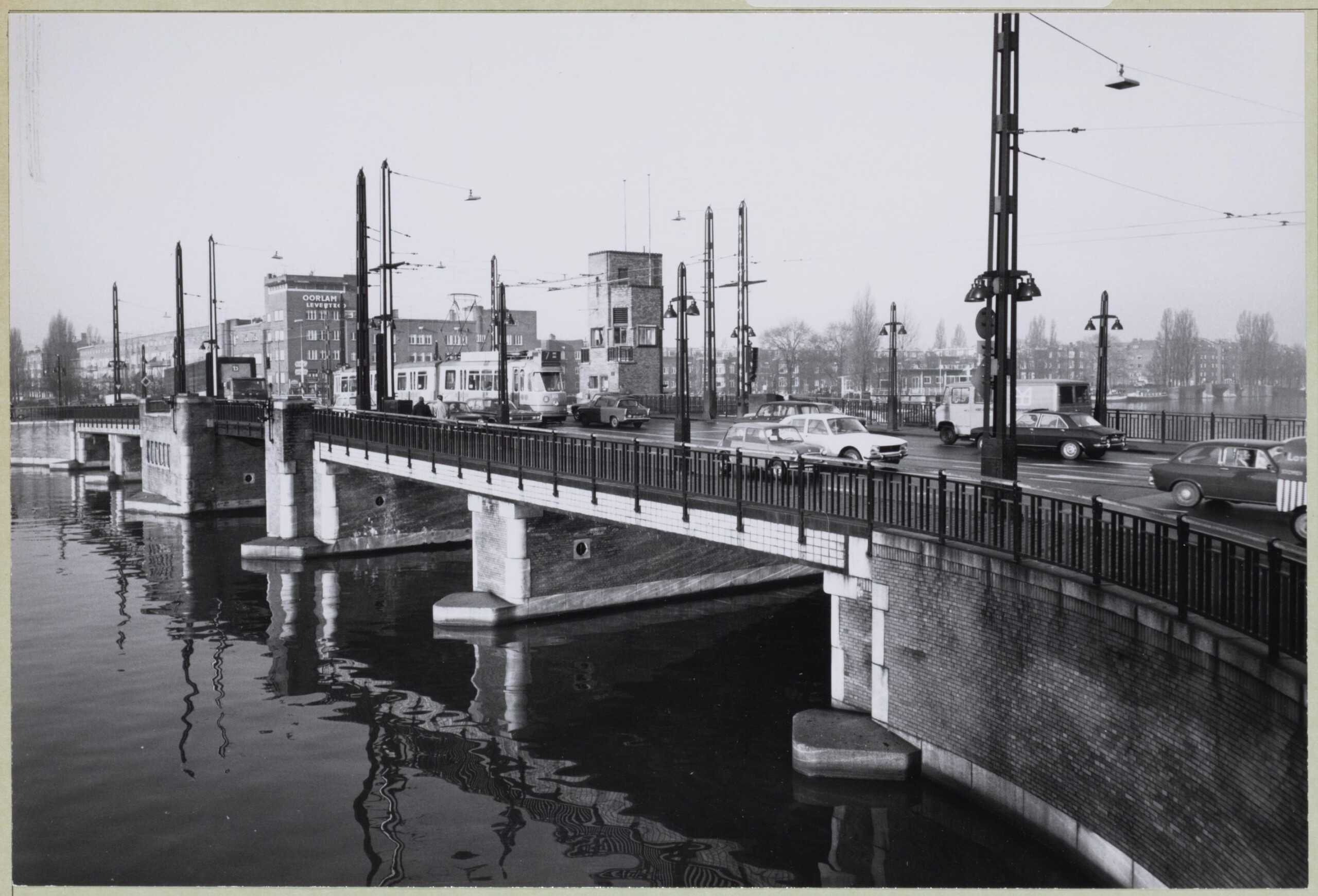
| Berlagebridge, 1972. Photo: Stadsarchief Amsterdam, DRO
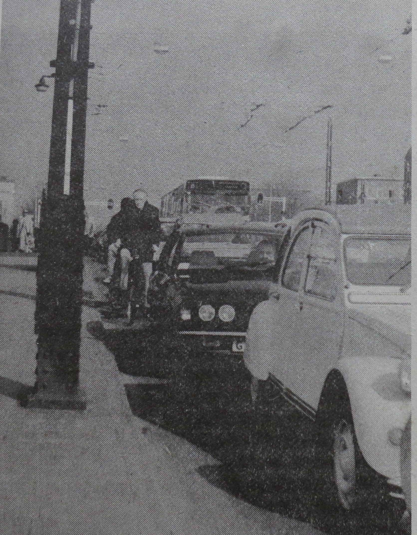
| Cyclists in difficulty on Berlagebridge, ca 1980. Photo: Archive Fietsersbond Amsterdam
Motorway offers opportunities
In 1982 an opportunity arose when the southern part of motorway A10 was opened. The new motorway with a new bridge over river Amstel provided extra capacity for cars. This was reason for Amsterdam’s Cyclists Union to plead for turning two car lanes on Berlagebridge into cycle paths. With success!
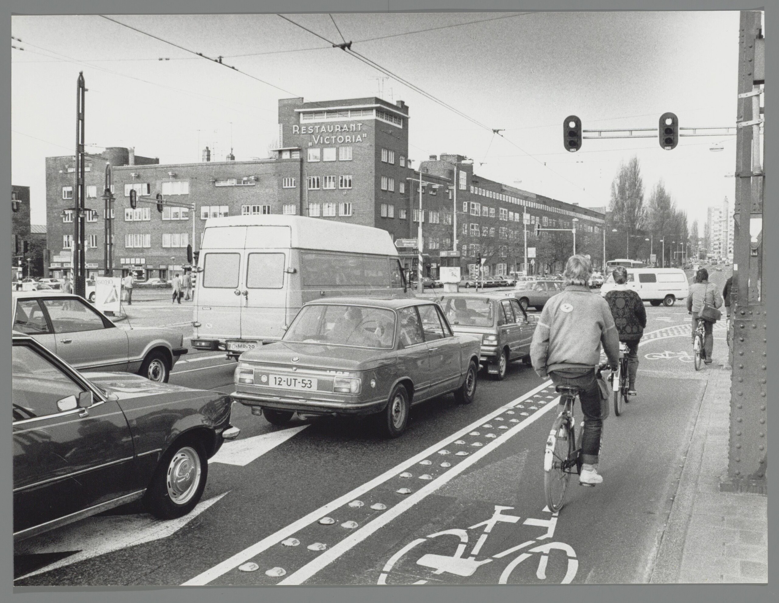
| Bike lane on Berlagebridge, 1982. Photo: Stadsarchief Amsterdam, Amsterdams Stadsblad
The bike lanes were of great benefit to cyclists. Car drivers had to adapt to the new situation. During the first days, huge traffic jams formed at Berlagebridge, but soon most car drivers found the new route via motorway A10.
Cycle lane back into car space?
However, two years later a new proposal suggested to turn the northern bike lane back into a car lane again. Cyclists would then have to travel via a narrow bike lane on the pavement. Joint action of Cyclists’ Union, schools and citizens prevented this. The bike lanes remained.
Some years later, the bike lanes were turned into the present grade separated bicycle paths.
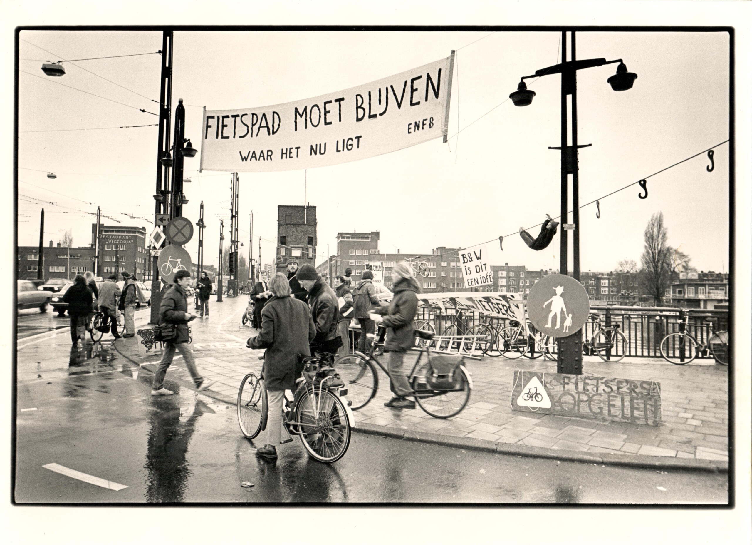
| Action Bike path must stay, 1983. Photo: Archief Fietsersbond Amsterdam
Results and new challenges
Because cars on Berlagebridge made space for cycle paths, the connecting roads became less crowded with cars as well. This is one of the reasons that bicycle traffic in Amsterdam has been growing steadily since the 1990’s.
Also the strong increase in bicycle-train traffic contributes to the growth of cycling. Many cyclists on Berlagebridge go to the nearby Amstel train station.
To make space for the growing numbers of cyclists the intersection at the eastern end of Berlagebridge has been adapted. Cycle space has been expanded and made clearer. Similar measures are planned on the western side of Berlagebridge.
The measures are based on the study Desire Lines Analysis, in which cycle flows at several busy intersections are investigated.
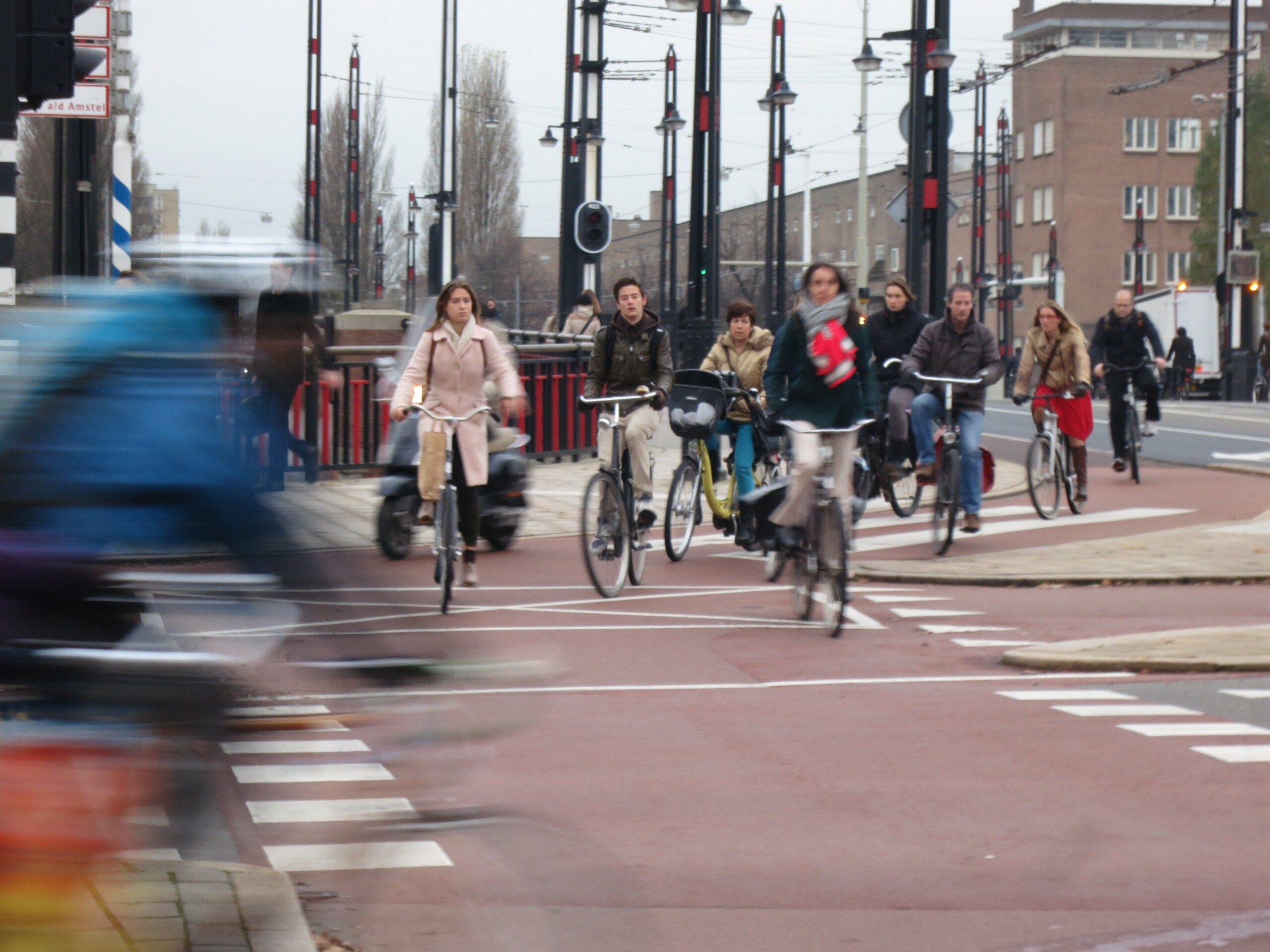
| Large numbers of cyclists at eastern side of Berlagebridge. Photo: Marjolein de Lange, 2013
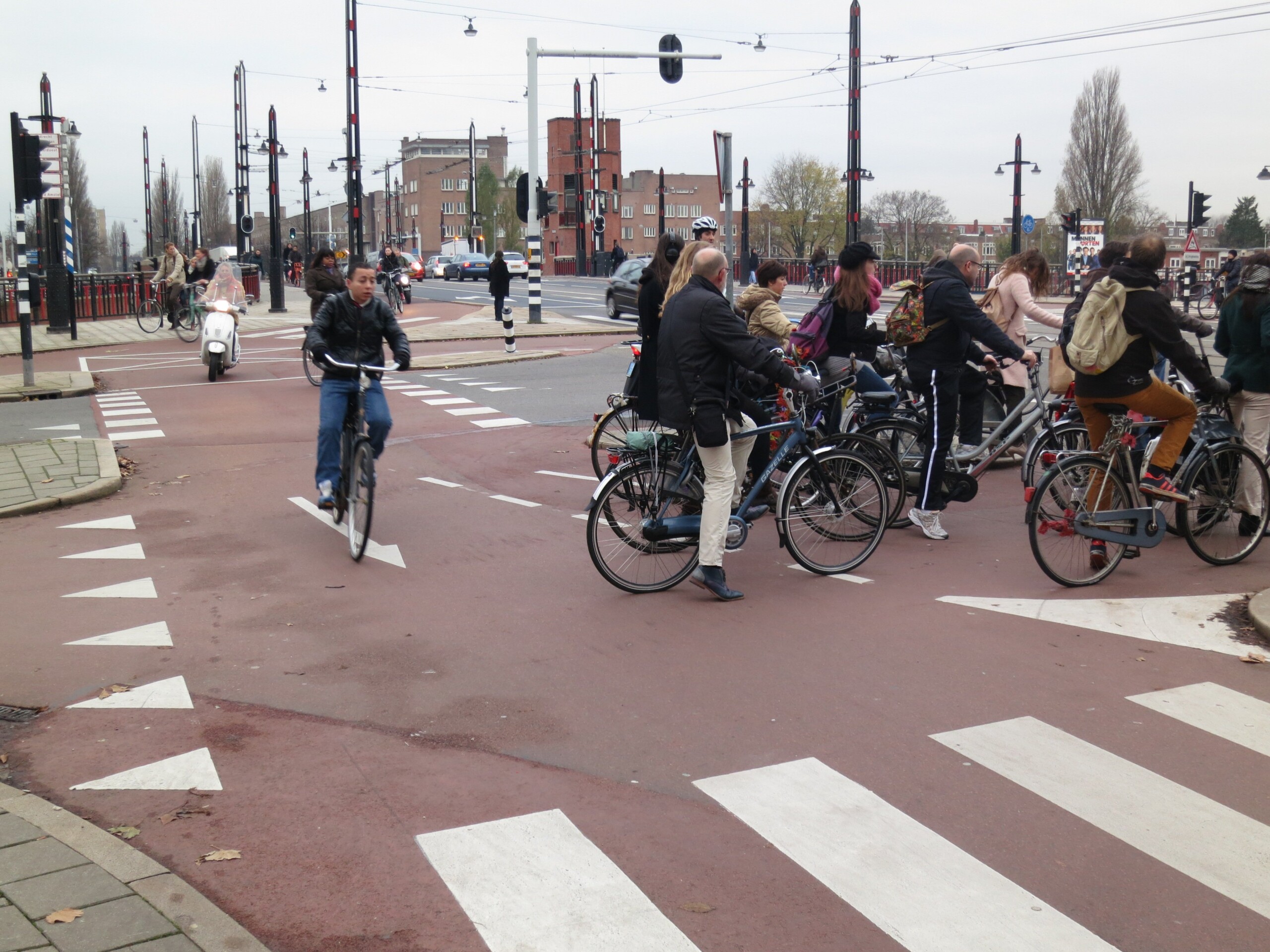
| Space and markings for safe flow of cyclists in different directions. Photo: Marjolein de Lange, 2013
More space for cyclists on Berlagebridge
The coming years Berlagebridge will be renovated. The bike paths will be widened from 2.10 metres to 2.40 metres. But the historic bridge cannot be enlarged and reducing space for cars and trams is not feasible either. The sidewalks will be narrowed from 3.5metres to 2.95 metres.
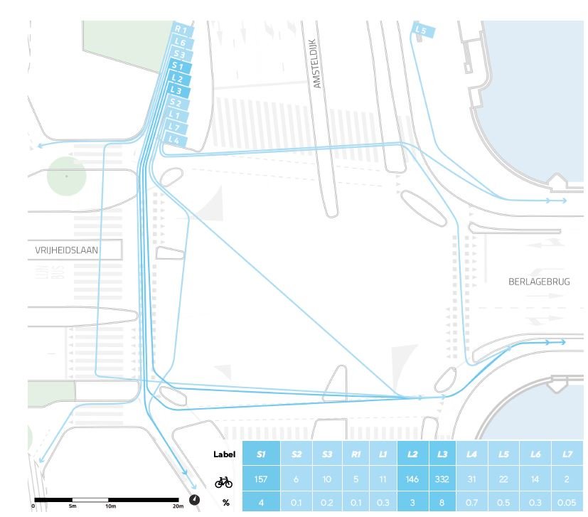
| Desire lines of cyclists at the intersection west of Berlagebridge. Measured on September 12th, 2017 from 8:15-9:15 am. Image from: Desire line study 2017 by City of Amsterdam and Copenhagenize
Lessons learnt
Turning car space into cycle space improved cycle safety and that led to more cycling. It also led to more efficient use of space. Berlagebridge can carry more people on bikes than in cars. To be honest, this was possible because the motorway provided new, and more, capacity for cars.
Did you know?
Berlagebridge is named after architect Hendrik Petrus Berlage. He made the urban plan for Rivierenbuurt, the 1930’s uighbourhood west of river Amstel. Rivierenbuurt is built in the typical Amsterdam School style, a modernistic style with interesting complex brickwork. Very worthwhile to take a look when you are here.
Bicycle Dutch vlog about Berlagebridge
Bicycle Dutch vlog about Berlagebridge
Our questions
Many cities have challenges with (re)distribution of space. Are you facing such challenges and can Berlagebridge be a helpful example? Is alternative capacity for cars always needed? Share your thoughts via Disqus below!


