Changing traffic policy in practice in Plantage Middenlaan
Plantage Middenlaan got an impressive redesign at Wertheimpark in 2015. Car traffic is no longer welcome. The roadway has been transformed into a green tram track.
This is the story of a street that was adapted to accommodate growing numbers of cars traffic. But where space for cyclists and pedestrians has been gradually reclaimed since the 1980s. An on-street example of the city’s changing traffic policy.
Plantage Middenlaan, a wide avenue adorned with trees in the 1900’s neighbourhood Plantage, is a connector road running from the east of Amsterdam towards the city centre. Similar to other streets, the growing number of cars took up more and more space and the old narrow bridge over Nieuwe Herengracht became a bottleneck. In 1960, the narrow bridge was replaced by a wider one to accommodate more motorized traffic.
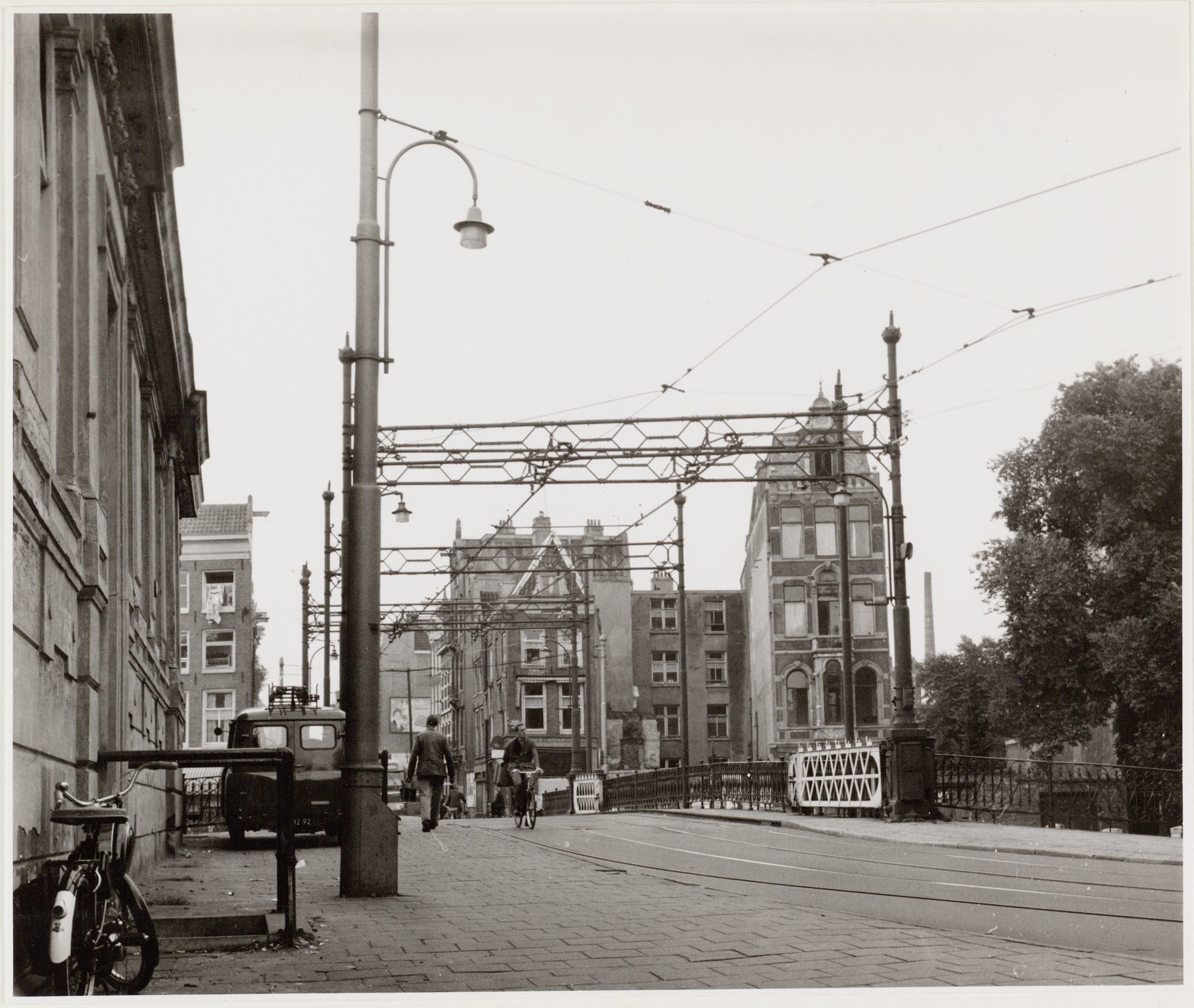
| Old narrow bridge, 1958. Photo: Stadsarchief Amsterdam / MA Knopper
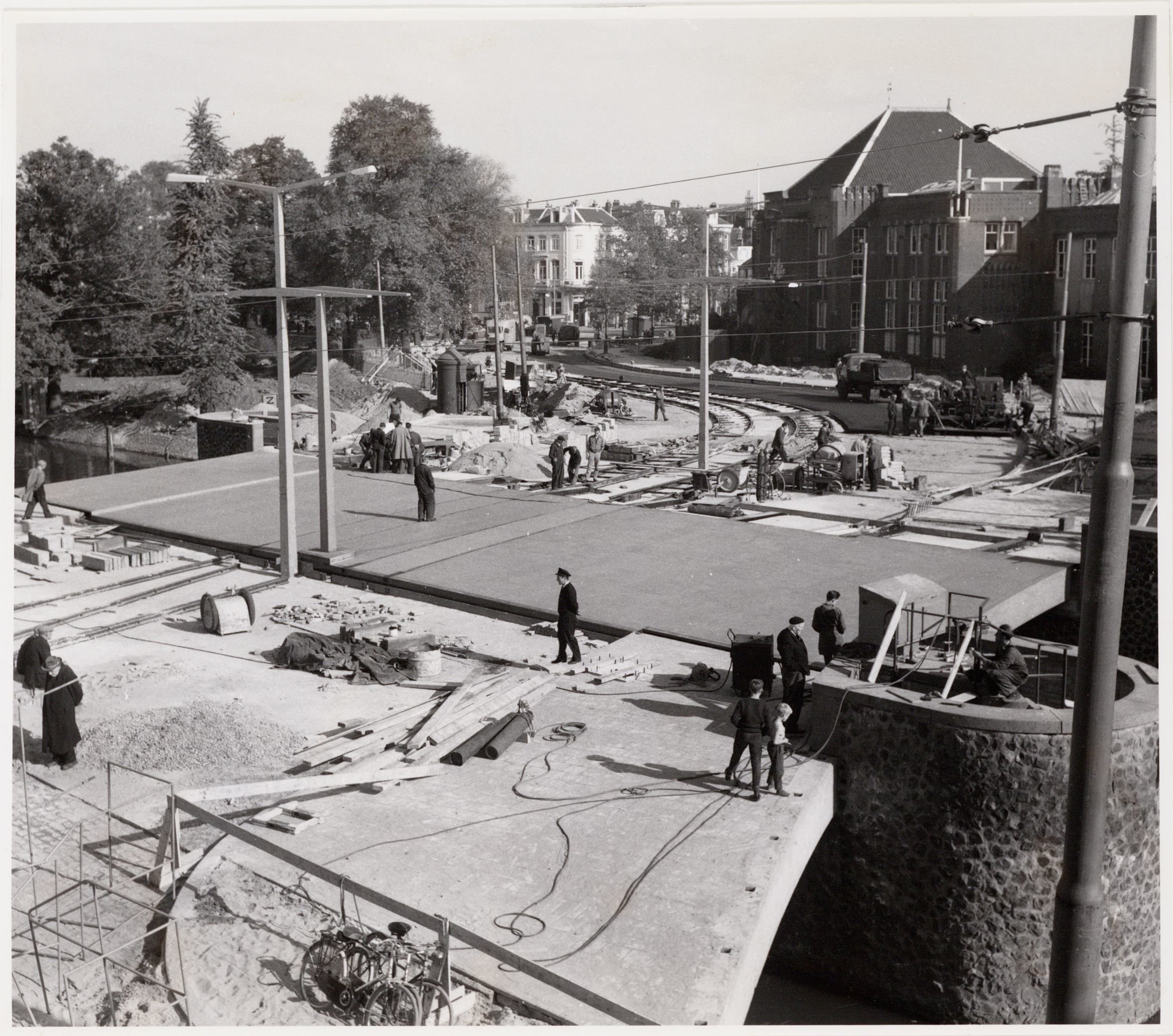
| New bridge, 1960. Photo: Stadsarchief Amsterdam / JM Arsath Ro’is
Plantage Middenlaan had a wide lane shared by cars, trams and bikes shared the space. However, the growing number of cars makes cycling unsafe and unnerving. The segregated bike lanes built in the 1980’s were a great improvement.
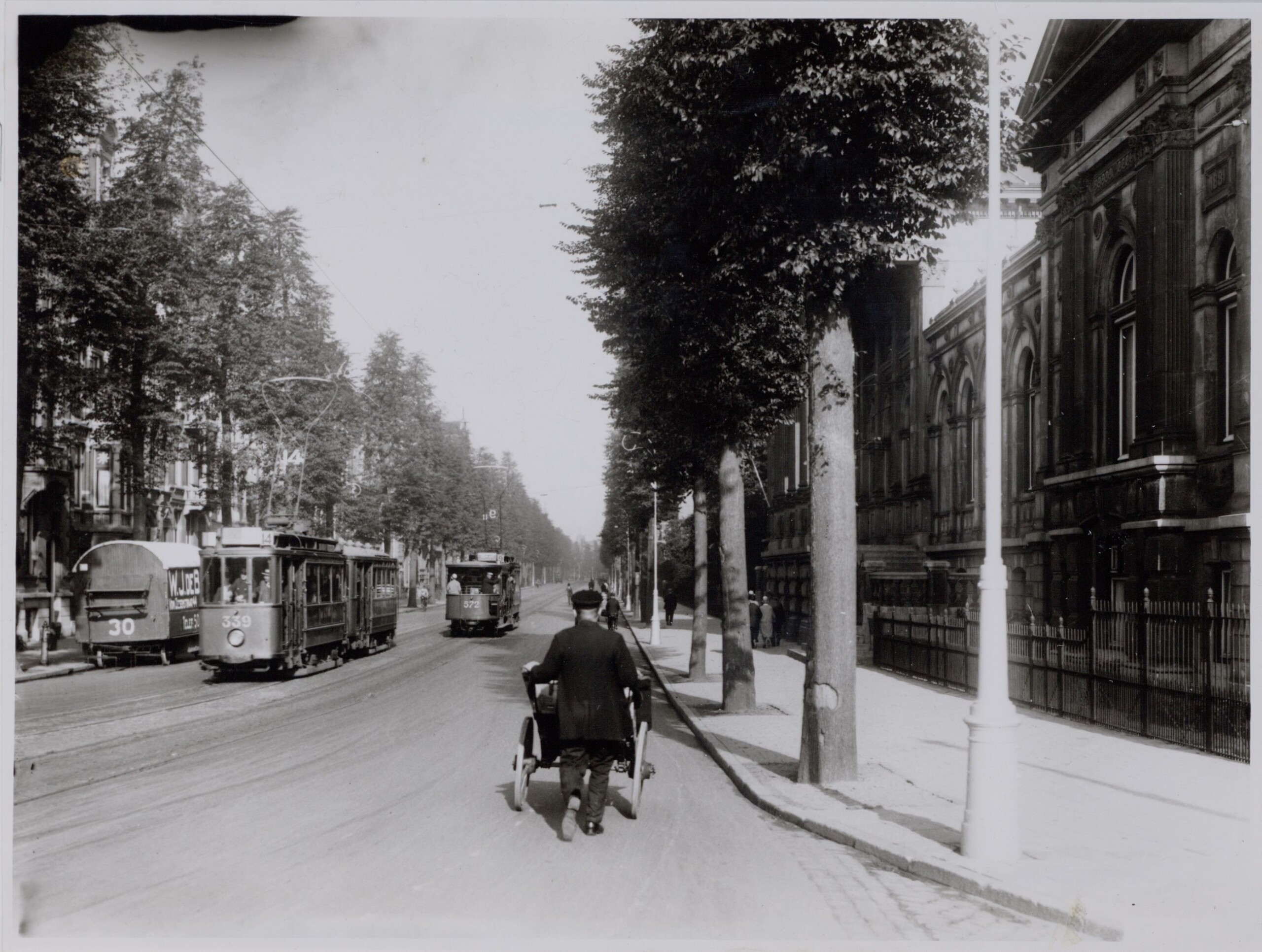
| Lots of space in Plantage Middenlaan, 1928. Photo: Stadsarchief Amsterdam / DRO
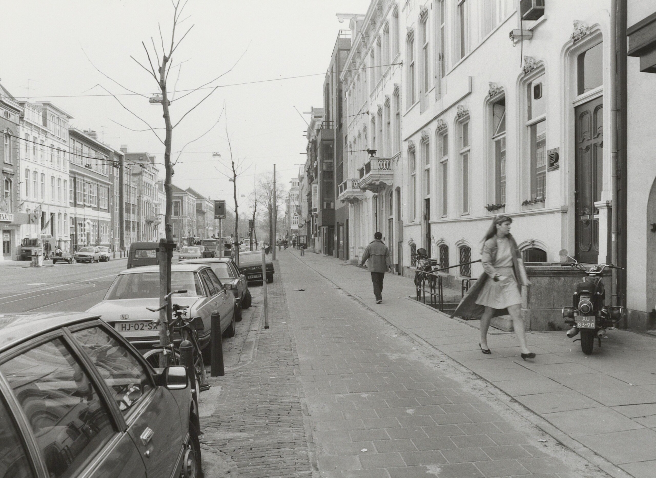
| Segregated bike lanes in Plantage Middenlaan, 1983. Photo: Stadsarchief Amsterdam / DRO
Since the 1980s, the space for cars has gradually been reallocated to pedestrians, cyclists and the tram. In 2015 cars were banned completely from the first part of Plantage Middenlaan at Wertheimpark. This is a result of the yearlong policy of reducing car traffic in the city.
Grass in place of asphalt helps to capture water in periods of heavy rainfall – an issue increasingly common with climate change.
The photos below show the transformation of this part of the street.
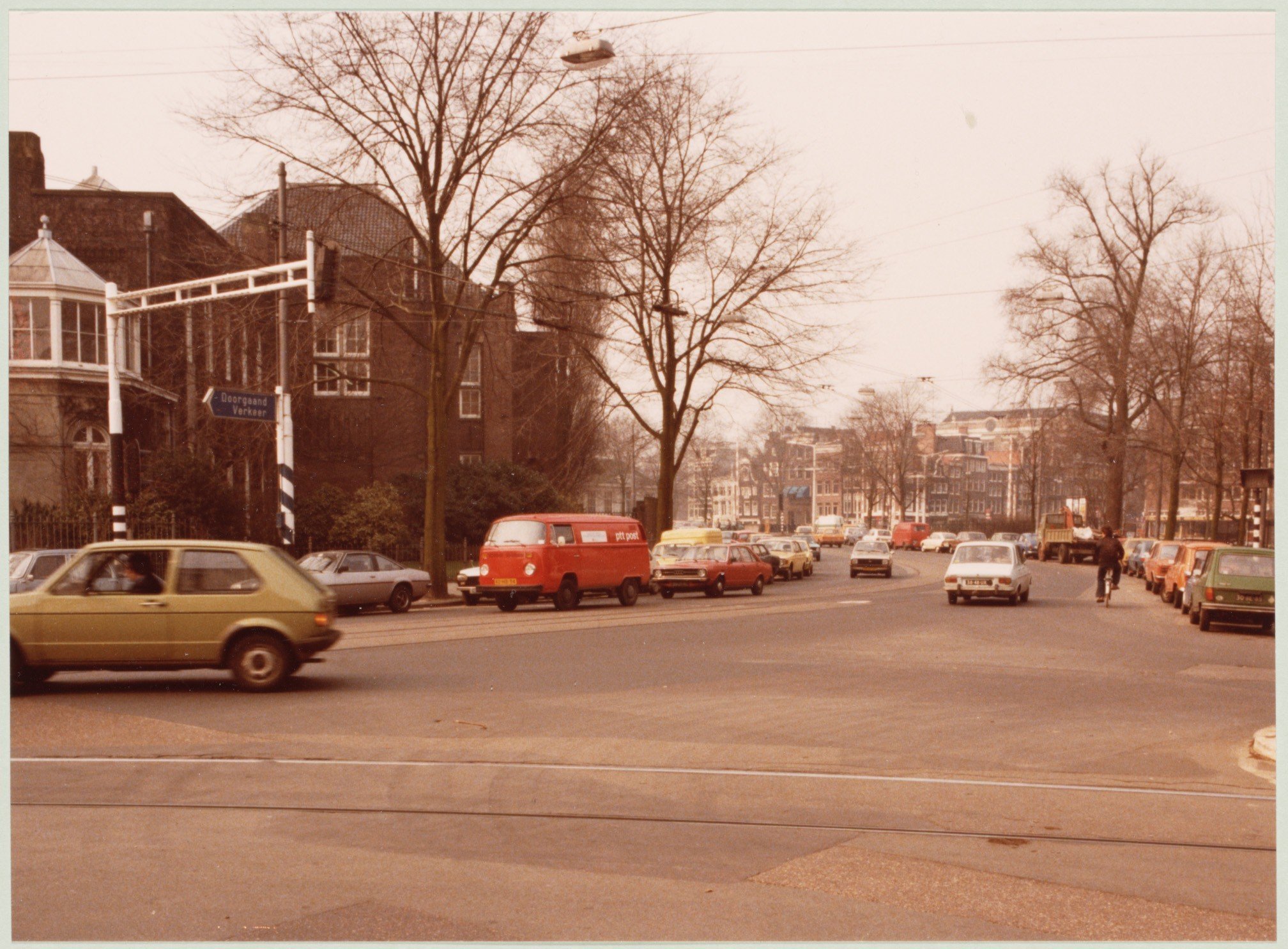
| Plantage Middenlaan near Wertheimpark 1980, Photo: Stadsarchief Amsterdam / DRO
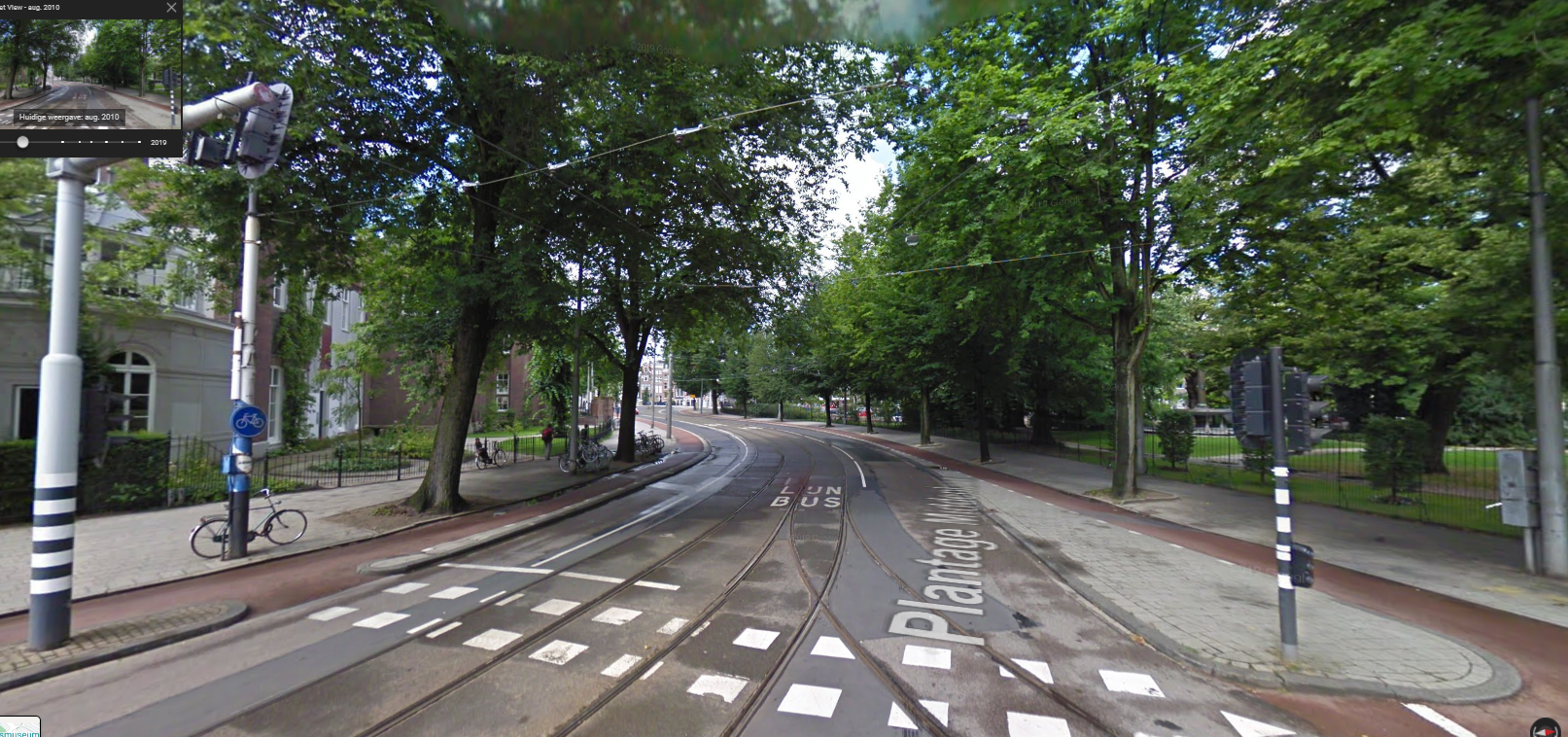
| The same spot in 2010. With bike lanes and trams and cars in the middle. Photo: Google Streetview
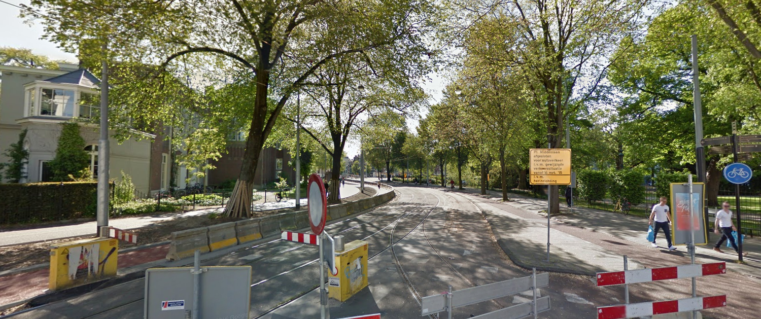
| The same spot in 2015, just when the section is made car free. With bike lanes and one way for cars. Photo: Google Streetview
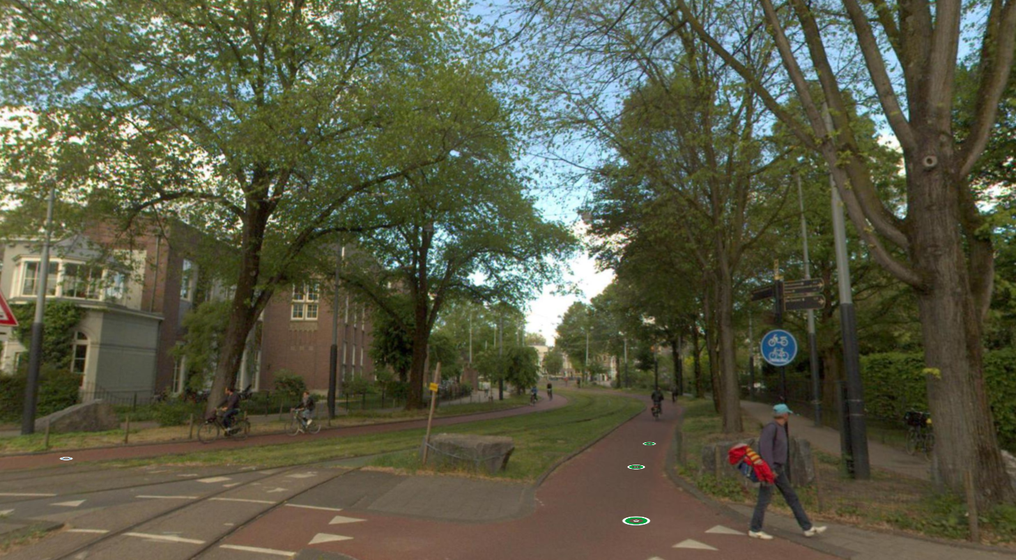
| The same spot in 2019. Car free, green trams lane and wide bike lanes. Photo: data.amsterdam.nl
Our questions
Does your city have innovative bicycle connections? How does your city deal with these types of infrastructural challenges? Share it below!


